Set up
Edit your parade map
Reshape your route, add lineup and dispersal lanes, place stations and resources, close roads, and choose which layers show on the map.
The map is where your parade physically takes shape. On top of your route you build everything else: where units line up, where they leave from, where your staff stand, and which streets are closed. This guide covers the editing tools and what each one does.
Turn on editing
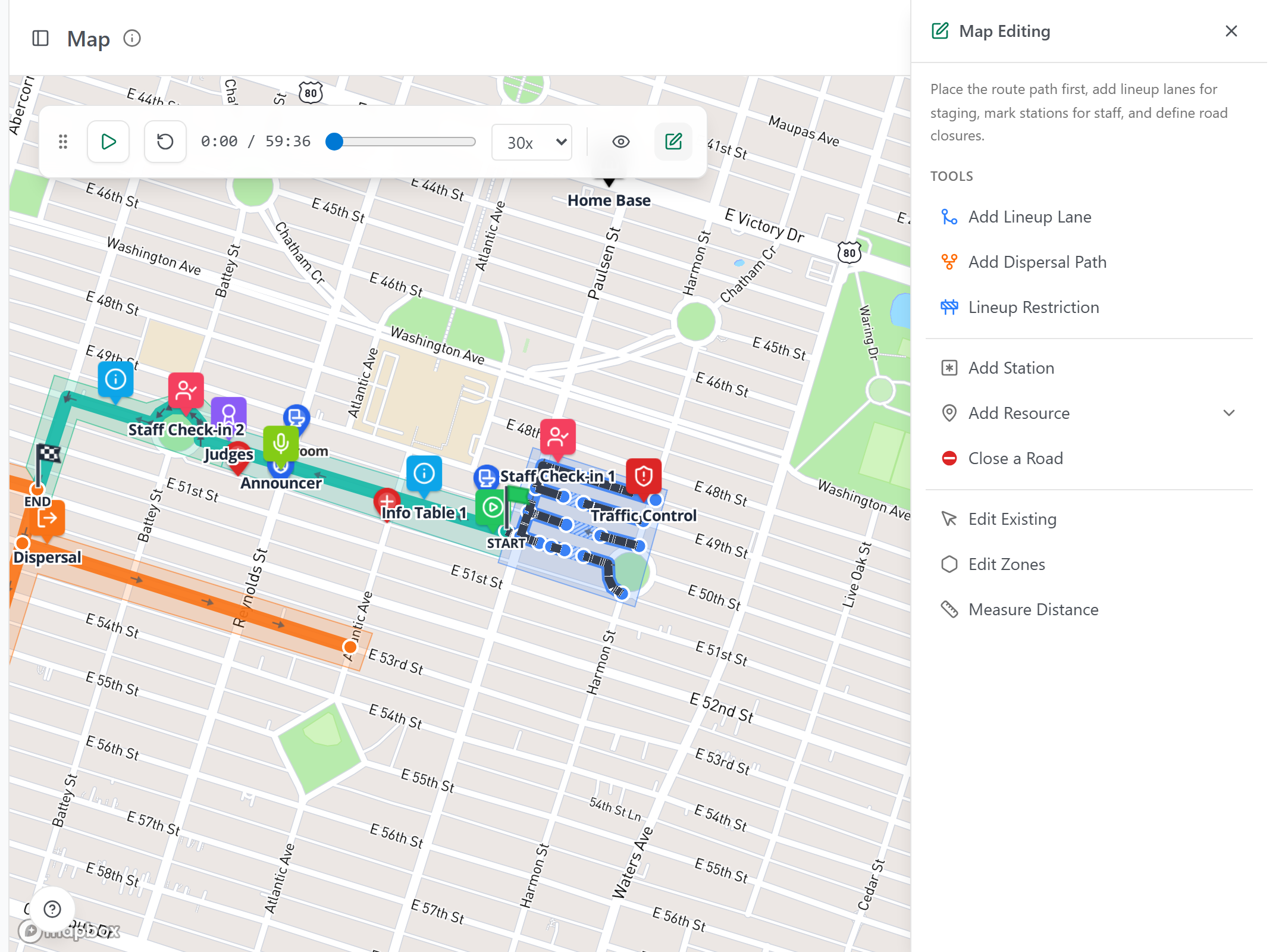
The map normally shows a preview you can play the simulation on. To make changes, click the pencil button in the toolbar above the map (its tooltip reads Edit Map). A panel titled Map Editing opens along the right side with all the tools, grouped into paths, objects, and utilities. Click the pencil again (tooltip Exit Edit Mode) when you're done.
What each tool does
Pick a tool from the panel, then follow its on-screen prompt. The panel groups them the same way they're grouped here.
Paths shape the flow of the parade:
- Add Lineup Lane adds a merging lane for more lineup space. Click an existing lineup segment to set the merge point, then draw the new lane.
- Add Dispersal Path adds an exit route for units finishing the parade. Click an existing dispersal segment to set the fork point, then draw the route.
- Lineup Restriction keeps intersections, fire hydrants, driveways, and other areas clear of staging.
Objects are the things you place on the map:
- Add Station marks a spot for people, supplies, or equipment (judging stand, first aid, announcer booth). Click the map to place one.
- Add Resource places a supply or service, like a barricade or water stop. Expand it to pick from your resource types or add a custom one.
- Close a Road blocks a road from parking or traffic, with an optional schedule so it shows closed only during the hours it actually is.
Utilities help you adjust and check your work:
- Edit Existing lets you drag nodes, stations, resources, and road closures you've already placed. This is also how you reshape the route: drag its points, or click the route line to add a new bend. Right-click a point for more options.
- Edit Zones draws coverage zones, the work areas you assign staff to.
- Measure Distance measures between points you click on the map.
Do not worry about how units move around corners. The app handles turns for you, and that behavior is set intentionally. Just shape the path.
Choose which layers show
Click the Views button (the eye icon) in the toolbar to open the Views panel. It has four groups:
- Map Type: road, satellite, or grayscale.
- Route Sections: show or hide the lineup, route, performance, and dispersal sections.
- Visibility: nodes, units, warnings, waypoints, resources, stations, coverage zones, road closures, and 3D Mode.
- Map Labels: place names and street names.
You can also save named views to come back to later. Toggling a layer only changes what you see. It never changes your underlying data, so switch things on and off freely to reduce clutter while you work.